
August heatwave could follow July washout

The disappointing July washout is set to give way to a heatwave in early August.
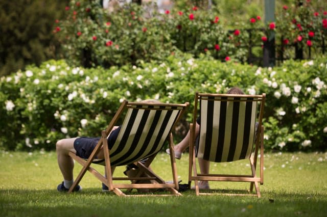
Just as we packed away the BBQ and the summer furniture, it could be time to get them out of the shed again as forecasters suggest the recent torrential rain and wind will be replaced by sun.
See also: Devon beach named best in UK
Leon Brown, meteorologist at The Weather Channel, told Aol Travel: "Temperatures will warm up over the south later next week.
"The weekend of 1 August currently looks better with more sunshine and warmer with temperatures in the low 20s."
Speaking to the Mirror, James Madden, forecaster for Exacta Weather, goes one better and suggests a return to the searing heatwave we saw in June. He said: "The transition to warmer and more settled conditions is likely to see temperatures surging to heatwave conditions for many parts of the country during the early part of August as high pressure becomes dominant across our shores.
"This pattern change is likely to be quite significant and it will lead us in to a largely settled August with periods of warm to very hot weather for many, in particular in parts of the south."
But we've got a week of unsettled weather to get through before we feel the sun.

Chris Burton at The Weather Network, told Aol Travel: "Yet another deep area of low pressure will bring an autumnal feel to the start of the week right across the UK, with low temperatures, frequent showers and strong winds.
"Northern areas will see the heaviest rain on Monday with temperatures well below average. Glasgow is forecast to see a max temperature of just 12C today (Monday) – that's around 7C below average for the time of year and more typical of an October day rather than late July!
"It will be drier further south on Monday but here the strength of the winds will be the issue.
"A weather warning has been issued by the Met Office for south-west England and south Wales for the risk of 40-55mph gusts throughout Monday until 9pm.
"The area of low pressure will slip to the east of the UK for Tuesday and Wednesday, meaning there will be some sunshine between the showers.
"However, it also means northerly winds will drag in even cooler air across the country, straight down from the Arctic.
"Daytime highs from now until Thursday will widely be between 5C and 8C below average for late July, with most places seeing temperatures in the mid teens."
Roll on the weekend...

Related articles
Where's summer one? Met Office warns of gales and torrential rain
'Fog river' seen rolling off a clifftop in Iceland


