
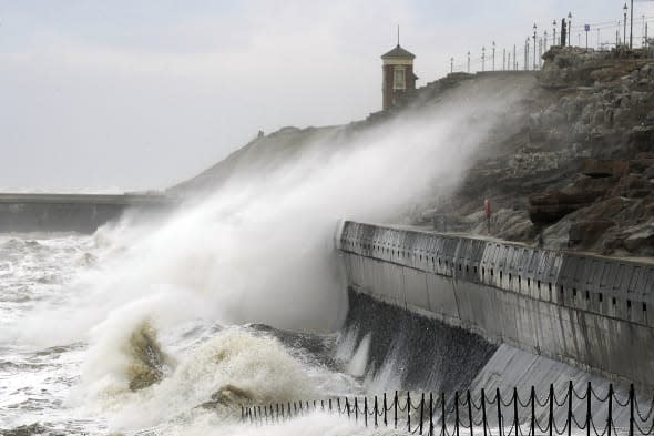
UK weather: Flood warnings as huge waves set to batter Britain
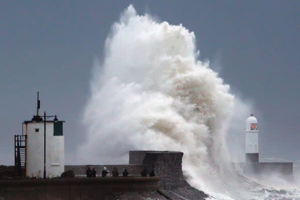
Britons have been warned to expect a wintry weekend as coastal areas are hit by huge waves which could cause flooding for local communities.
The Environment Agency has issued 24 flood warnings and 63 flood alerts for England and Wales.
According to the Daily Telegraph, emergency teams are on standby in Cornwall, Devon, Kent, Somerset and Sussex.
Waves could reach up to 50ft in height, partially triggered by the new moon which is its closest to Earth in an 18.5 year orbit.
Meanwhile, the Met Office has issued a yellow severe warning of snow for Sunday and says: "Rain, sleet and snow spreading east on Sunday will tend to turn back to rain, but remain as snow on high ground where accumulations of more than 5cm are expected in places. Winds will gust to over 50 mph on coasts and hills, leading to blizzard conditions on high level routes."
For Monday it says winds will be strong, "with gusts to over 50 mph on coasts and hills."
Chief forecaster Leon Brown at The Weather Channel tells AOL Travel: "This weekend will be cold. Expect a frosty and icy start to Saturday and then sunshine and wintry showers over the north and west with hail and sleet at lower levels and some snow over the higher parts of Wales, Pennines and Scottish Mountains. Isolated showers are likely over the south and east, but even so temperatures will struggle to lift above 6 to 7C."
"There will be another widespread frost on Saturday night, and cold, bright and frosty start to Sunday morning over the south east. The weather will quickly deteriorate from the north and west and become very wet.
"It will be a washout afternoon everywhere with fresh to strong south west winds - 5 to 10mm of rainfall over central to southern Britain and 15 to 25 over parts of the west."
Leon adds that next week will start colder and windy with a lot of showers over the north and west, driven inland by the strong to gale west winds.
Blizzard conditions are expected over the Scottish Highlands, "and we may even see some sleet and wet snow over central Britain on Monday night to early Tuesday, although any accumulations mainly above 200m."
There will be some respite on Wednesday when it is less cold with a thaw of any hill snow, "but another active cold front will sweep south on Thursday followed by wintry showers in the north and west."
Mr Brown says: "This changeable westerly weather pattern looks set to continue to early March, but gradually pressure will build from the south as the jet stream moves northwards again. The weather will become drier over the south with more sunshine, but also night frosts. So, spring-like in the sunshine, but chilly nights."

Related articles
Mystery as 20 swans die in same stretch of UK river
Niagara Falls freezes as extreme weather hits US


