
Snow, gales and tornados bring travel chaos to Britain
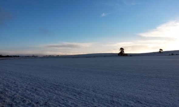
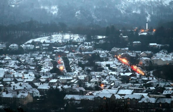
Parts of Britain woke up to a snowy wintry scene on Wednesday - but snow and ice have brought travel chaos, and even a tornado.
One couple's garage was flattened by a twister in Harrow, while there were reports of tiles being stripped from roofs and 'flying' wheelie bins.
Firefighters were called to Grafton Road in Harrow after a tree was pulled out of the ground and landed at the end of the street.
According to the Standard, the crew said it was like "a scene from the Wizard of Oz."
Watch manager Mark Ritson said: "The tornado whizzed through the area, some roof tiles were blown off and caused minor damage to properties and cars in nearby roads but fortunately nobody was injured."
There's also been widespread travel disruption. Several roads in northern Scotland have been closed while a lorry jackknifed on the A9 south of Newtonmore.
The Met Office has issued an amber "be prepared" alert across central and southern Scotland, with Wales, Northern Ireland and much of England also on alert.

It comes after blizzards disrupted travel and closed schools in Scotland on Tuesday.
Gritters were out in force last night and commuters have been told to expect some delays and cancellations of services.
Network Rail has suspended four train routes and the AA said its crews were ready for a busy 48 hours.
In Aberdeenshire the A93 Glenshee to Braemar route has been closed, as has the B974 Banchory to Fettercairn road and the A939 Ballater to Corgarff.
Traffic Scotland said there was heavy snow at the Rest and Be Thankful in Argyll and Bute, while on the A9 lorries stuck in snow caused delays for a time.
Darron Burness, from the AA's severe weather team, said: "It's a case of 'expect the unexpected' and drive accordingly."
The wintry blast took effect in Scotland on Tuesday, forcing the closure of more than 30 schools in the Highlands and creating difficult driving conditions.
The Met Office said: "There is a risk of two spells of persistent snow. The first of these is likely to cross the amber area on Tuesday evening, with another one affecting the area on Wednesday morning - both of which could produce disruptive snowfall during busy travel periods.
"Meanwhile, snow is likely to continue to accumulate throughout this period on high ground.
"The public should be prepared for the risk of disruption and difficult driving conditions."
The amber warning, in place until 10am, follows last week's fierce storms which left 120,000 properties without power in Scotland.
The homes have since been reconnected but BT is continuing to fix phone lines in the Highlands and Islands.
Repair efforts have been hampered by fallen trees, ferry cancellations and traffic restrictions.
Road operator Bear Scotland said its teams were working around the clock to keep routes clear, while Police Scotland said drivers should ask whether their journey is really necessary before getting behind the wheel.
Chief Inspector Louise Blakelock said: "If you do decide to travel, ensure your vehicle is well prepared before setting off, make sure your windscreens are completely free of snow and ice, and your lights are working and clean."
Network Rail said a limited number of train services would be suspended from noon today, when the worst of the winds are expected to strike.
No trains will run on the Dumbarton Central to Helensburgh Central and Glasgow to Oban lines until 6pm on Thursday.
The Kyle to Dingwall and Kilwinning to Ardrossan line will also be suspended.
David Dickson, route managing director for Scotland, said: "Safety has to be our first consideration during severe weather.
"Where conditions are predicted to be most severe, we have agreed to withdraw a limited number of services until the worst of the storms have passed."
A yellow "be aware" warning for snow and ice remains in place across Wales, Northern Ireland and much of England, with sleet and snow showers possible overnight.
West Midlands Ambulance Service said: "Our crews are reporting snow in West Mercia, Birmingham, the Black Country and parts of Staffs and Warwickshire. Some minor issues on roads.
"A few reports of cars slipping and at least one jack-knifed lorry. No injuries so far thankfully. Please take care out there."

Leon Brown, meteorologist at The Weather Channel, says we could expect more snow next week, and temperatures are likely to be below average for the rest of the month.
He told Aol Travel: "The deep cyclone developing in the mid-Atlantic will cross the North West of Scotland late on Wednesday night to Thursday. The strongest winds over southern Britain will be on Wednesday evening with widespread south west gales and severe gales around coasts. There will be gusts of 50mph to 65mph inland and 70mph to 90mph around coasts and over hills and mountains in West England and Wales.
"The other feature will be heavy rain with 20mm to 40mm over West Wales, Cumbria and South and West Scotland so local flooding likely. Not a good night to be out on the roads, and weather will deteriorate very quickly from the west on Wednesday evening.
"The deep low then moves slowly from Scotland to the north of the North Sea with very strong and gusty winds on Thursday across the northern half of the UK, gusts again 60mph and higher over the Pennines and Scottish Mountains. Southern Britain will be gusty but nothing too extreme for Thursday, and plenty of sunshine too.

"Once the overnight rain clears in the south east early on Thursday the weather will become bright with sunshine and scattered showers over much of England and Wales, but more persistent and heavier rain, sleet and hill snow moving down across Scotland to North England and Ireland.
"We may see some heavy snow over the Pennines in the afternoon and evening with blizzard conditions.
"From Friday, the winds ease and veer to the north or north west, and everywhere will get a lot colder again. There'll be hail, sleet and snow showers around coasts and some sleet and snow showers moving inland. The detail becomes difficult on where snow is likely, but we should prepare for freezing temperatures and very icy conditions for the coming days, and probably much of next week too.
"There is a risk of some more widespread snow early next week as an occluding Atlantic front slides down the western side of the UK, but could push further east to bring a spell of snow later on Monday and Tuesday.
"We can also expect some very low temperatures, the lowest of the winter so far. Temperatures below minus 10C are quite likely in Scotland, perhaps as low as minus 15C. Over mid Wales too temperatures may dip to below minus 10C where there is lying snow early next week."


Related articles
'Violent' storm to hit UK at the end of the week
Snow and sleet on way after hurricane-force winds hit Britain


