
UK braces for ‘increasingly wintry’ weather as cold front arrives from Scandinavia
A cold front from Scandinavia is set to hit Britain with freezing temperatures and snow in the next few days.
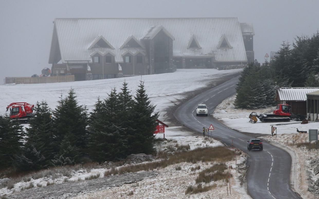
Temperatures may plunge to as low as -5C (23F) even in rural parts of southern England, with warnings of ice on roads and heavy frosts as well as some snow forecast in the Pennines and Welsh mountains.
The first widespread frost of the autumn for much of the UK on Saturday led to sub-zero temperatures as far south as Somerset with only the north of Scotland and parts of the east and south west of England staying widely above freezing overnight.
However, it will turn colder again through Monday evening with a return to widespread overnight frosts. Conditions will also be largely dry, though some rain showers along the east coast could turn to sleet over higher ground.
A Met Office spokesman said the cold and variable weather is to be expected at this time of year, though the UK has historically had the first frosts in October.
‘Colder than average conditions’
Dan Harris, Met Office deputy chief meteorologist, said: “Early next week, following a brief more unsettled interlude, we expect to see a return to widely cold but quiet conditions. Some rain, or showers, are likely to affect some parts of the east coast, and these could turn increasingly wintry over higher ground areas towards the middle of the week.
“Thereafter, confidence in the detailed forecast falls, which is typical when looking this far ahead. It does look as though there will be a trend towards something more unsettled, as areas of cloud and rain attempt to move across the UK.
“At present, the most likely outcome beyond mid-week is that rain from the west slowly moves east, with snow possible over higher ground, and a continued risk of showers over eastern parts.
“However, there is a chance that a more active weather system arrives from the south west, which would bring more widespread rain, stronger winds, and the potential for more significant snowfall should the air over the UK become sufficiently cold ahead of it.
“Either way, a continuation of colder than average conditions seems most likely, more details will become clear over the coming days and, as you would expect, we will be monitoring developments in the forecast closely.”
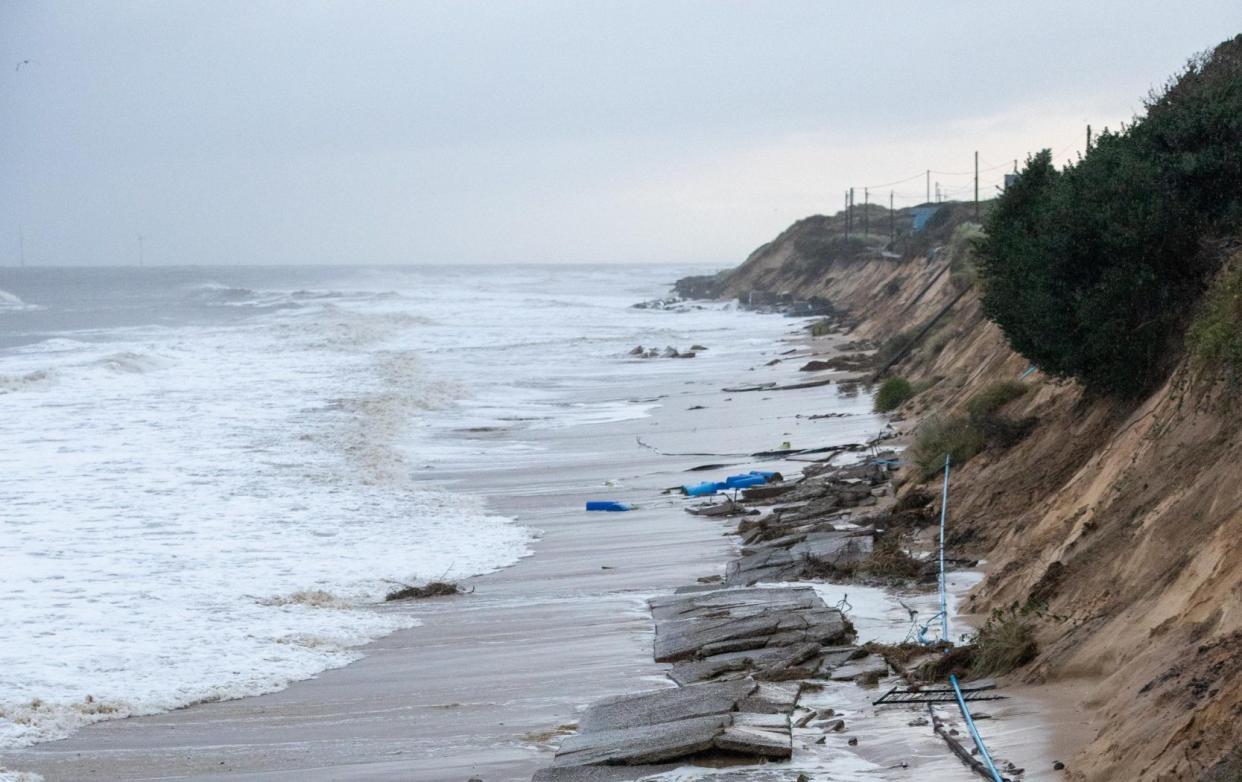
Meanwhile, people are being warned to stay away from a beach after the collapse of a cliff-top road brought power lines down.
High tides and wind caused “significant damage” at Hemsby in Norfolk, with several feet of cliff and dunes washed away on Friday.

‘It’s just too dangerous’
Hemsby Lifeboat posted on Facebook to say a 650ft stretch of road had fallen on to the beach.
Daniel Hurd, lifeboat coxswain, said: “Stay away – it’s just too dangerous.”
‘Cars left stranded’
Mr Hurd said erosion had led to power cables had fallen, cars had been left stranded and one disabled resident was unable to move from his home due to the collapse of the Marrams.
“People are unable to get to their properties; there’s no water supply, it’s an absolute joke,” he said.
The lifeboat crew, which is independent and not part of the RNLI, was helping residents while Norfolk Police closed off some roads.
Its lifeboat station is set slightly back from the Gap, an area of dunes at a lower point between higher sandy cliffs.

