
NSW weather: Sydney’s record run of rainy days in play as another wet week forecast
The lengthy soaking of eastern New South Wales, including Sydney, may have at least another week to run as a large high-pressure system all but stalls over Tasmania, the Bureau of Meteorology says.
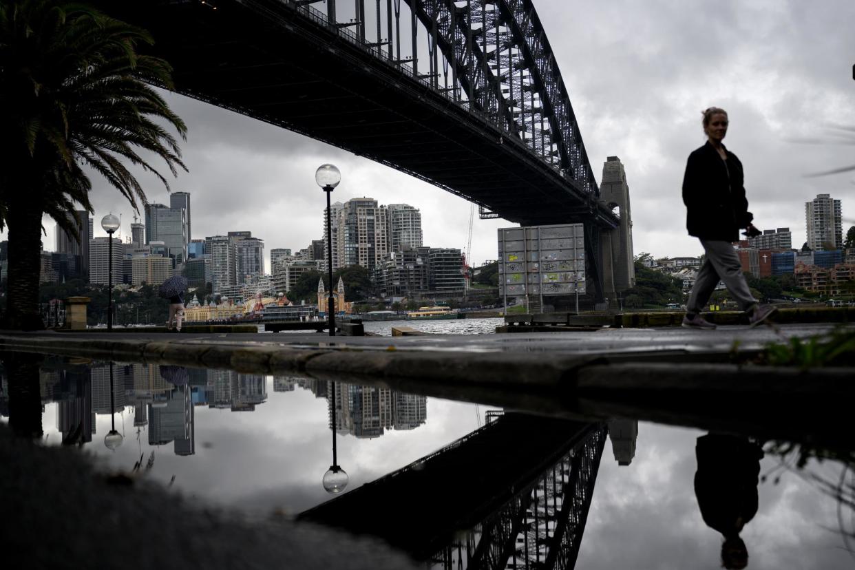
Sydney has already clocked up 124mm in the first six days of May, more than the long-run average of just over 117mm for the month. The city’s record of 16 consecutive days of at least 1mm of rain – set in 1943 and 2022 – could also be in play, according to Ed Medlock, a weather bureau meteorologist.
The high-pressure system has been dominating Australia’s south-east, directing bouts of showers and occasionally heavier falls on to coastal NSW.
“It’s our expectation that [the high will] stick around for at least a week or longer just based on where the upper winds are sitting,” Medlock said. “They are just not allowing it to progress into the Tasman [Sea].”
Rain will affect the NSW coast every day this week, with more widespread and heavier falls developing across eastern Australia between Thursday and Sunday. ☔️ pic.twitter.com/1Fp9S8doHU
— Ben Domensino (@Ben_Domensino) May 6, 2024
Places south of Sydney have had some of the heaviest falls in recent days, including more than 70mm at Kiama on Sunday. Ulladulla further to the south collected more than 60mm on both Saturday and Sunday.
The movement of a pool of cold air over inland NSW helped generate those heavier falls over the weekend. Similar conditions may return from Thursday, Medlock said.
Another cold air pool will “slowly make its way across the state … before reaching the coast and creating a coastal trough over the weekend”, he said.
The strong high pressure system near TAS is showing no signs of moving, which means more cloudy, showery weather for Australia's eastern seaboard. pic.twitter.com/fWwDcRgzR2
— Andrew Miskelly (@andrewmiskelly) May 6, 2024
While it was too far out to tell how large the falls will be, they could last into early next week.
The high-pressure system itself is unusually strong. On Sunday, it reached as high as 1,043 hectopascals – a measure of pressure – “which is close to record-breaking”, Medlock said.
The same setup that has been soaking eastern NSW has also delivered dry weather to much of southern Australia. Both Melbourne and Adelaide have mostly been dry for the past fortnight with the South Australian capital collecting just 12mm of rain in April or about a quarter of typical falls.
High-pressure systems that are very slow moving or almost stationary are known as blocking systems. Climate scientists say it is too early to tell how a warming planet will affect blocking systems in the southern hemisphere, such as making them more frequent and more persistent.
Martin Jucker, a climate researcher at the University of NSW, said blocking highs have been “a subject of concern to climate scientists in the northern hemisphere for a while now, as their impact on large populations has become clear with catastrophic heatwaves such as the 2003 European and Russian heatwave”.
The megablock continues. This is 7 days out, same big high. pic.twitter.com/h76YOoTLYR
— Glen (@Gergyl) May 5, 2024
“While there is some evidence that in the northern hemisphere the [upper level] jetstream might weaken and therefore allow for more blocking, the projections of the southern hemisphere jetstream do not suggest a weakening, but a poleward shift of the jetstream,” Jucker said.
“However, this depends on how quickly the ozone layer recovers, as that recovery acts against the effect of the greenhouse gases, and other uncertain factors such as what Antarctic sea-ice will look like in the future,” he said. “All of these things are extremely difficult to predict and more research is required to narrow the range of possible future outcomes.”
Related: Only one person has received grant to elevate home two years after NSW northern rivers floods
The effects on Australia will also depend on where the systems become stationary.
Chiara Holgate, a climate researcher at the Australian National University, said if the high-pressure system ends up stalling over the Tasman Sea and coinciding with a deep low-pressure system over south-east Australia, it may result in extremely high rainfall.
Such high-pressure systems are expected to become a little more frequent in the future – increasing about 2% per degree of global warming – but the number of low-pressure events may drop by about 9% per degree of warming, Holgate said.
“This doesn’t mean there will be fewer extreme rainfall days in future necessarily” as extremely high rainfall can occur from other processes such as thunderstorms, she said. “Research on how extremely high rainfall will change in the future is ongoing.”

