
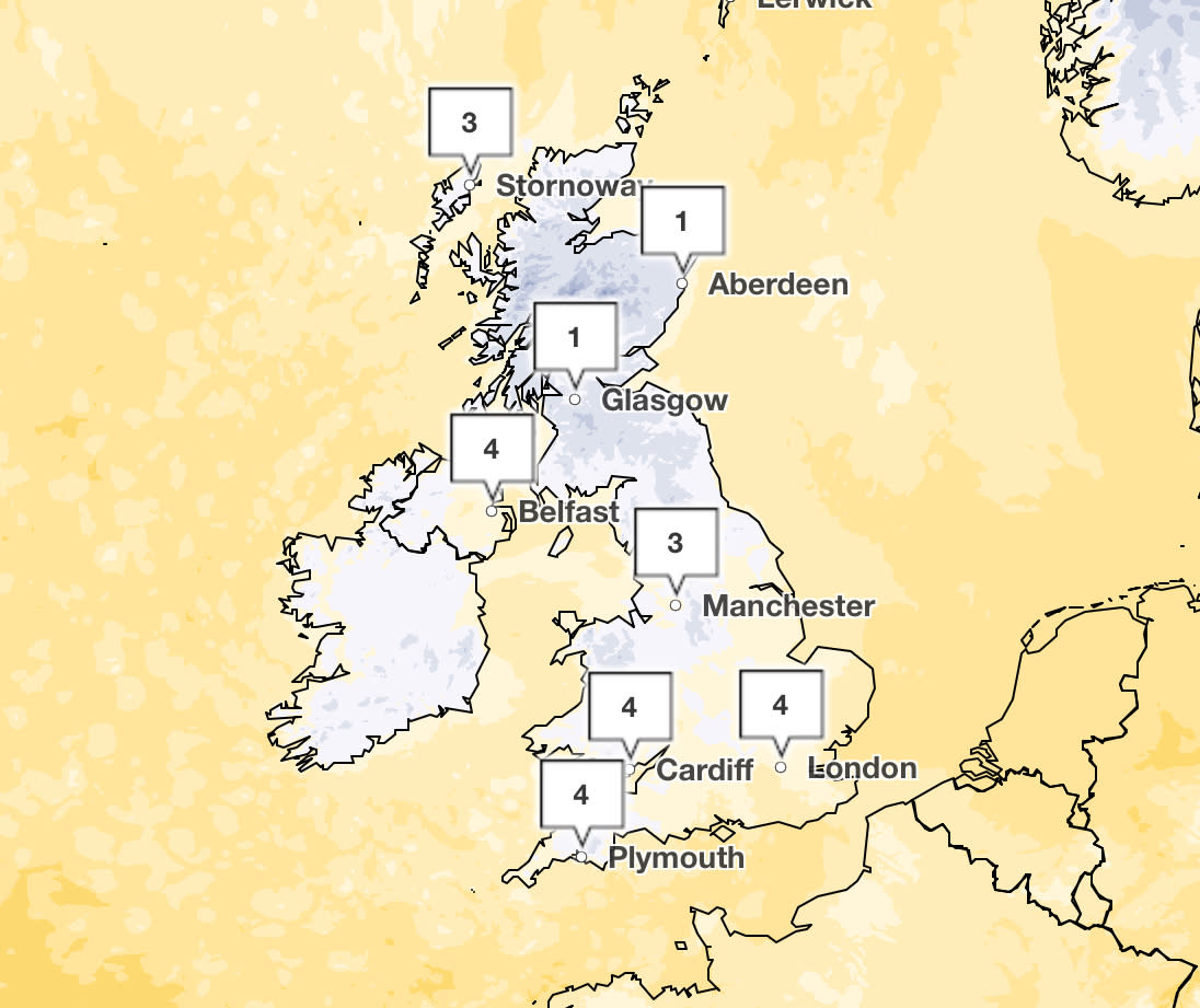
Met Office maps show where it could hail and snow in coming days
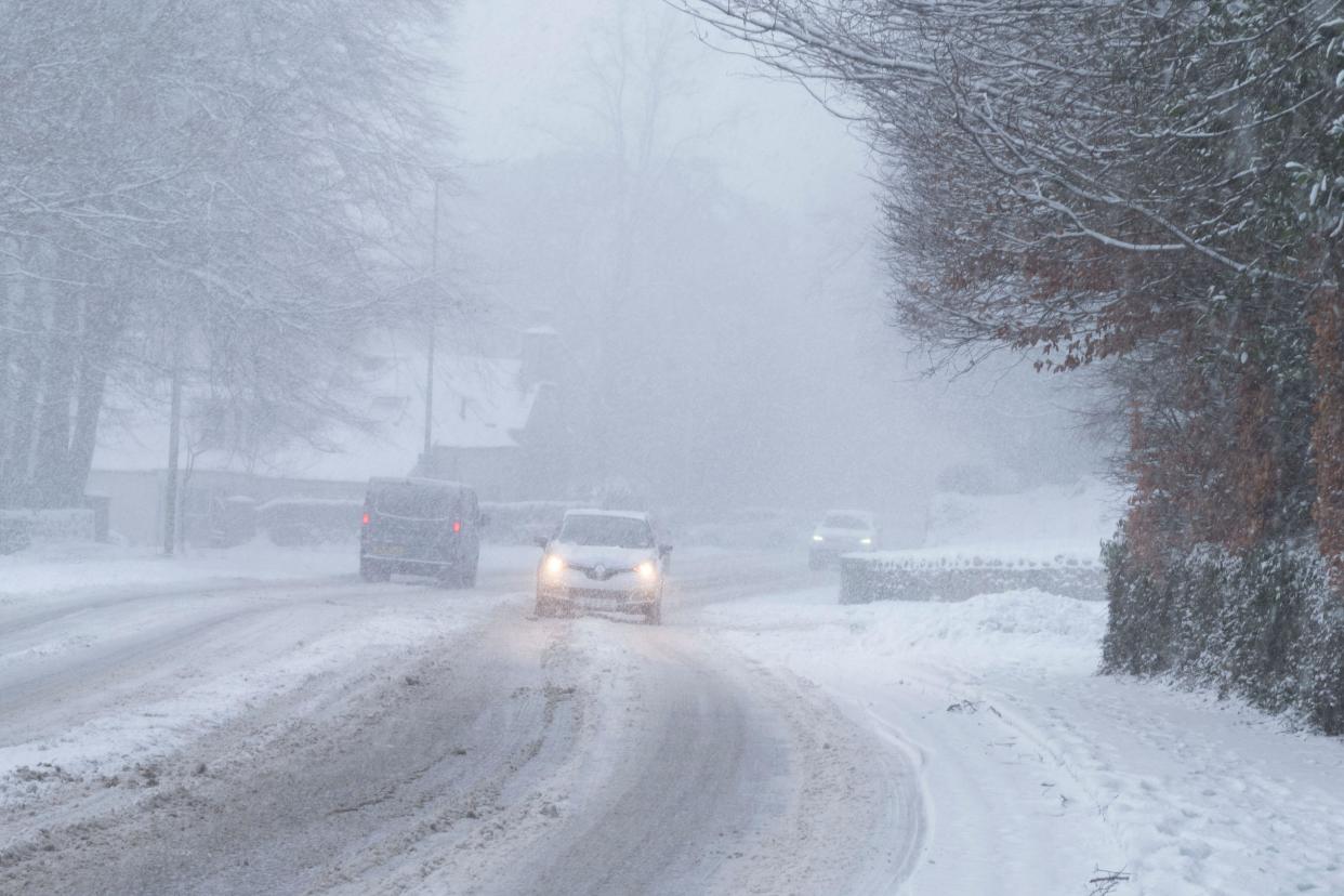
Following a brief milder spell, parts of the UK could be hit by hail and snow as temperatures turn colder and unsettled over the next few days.
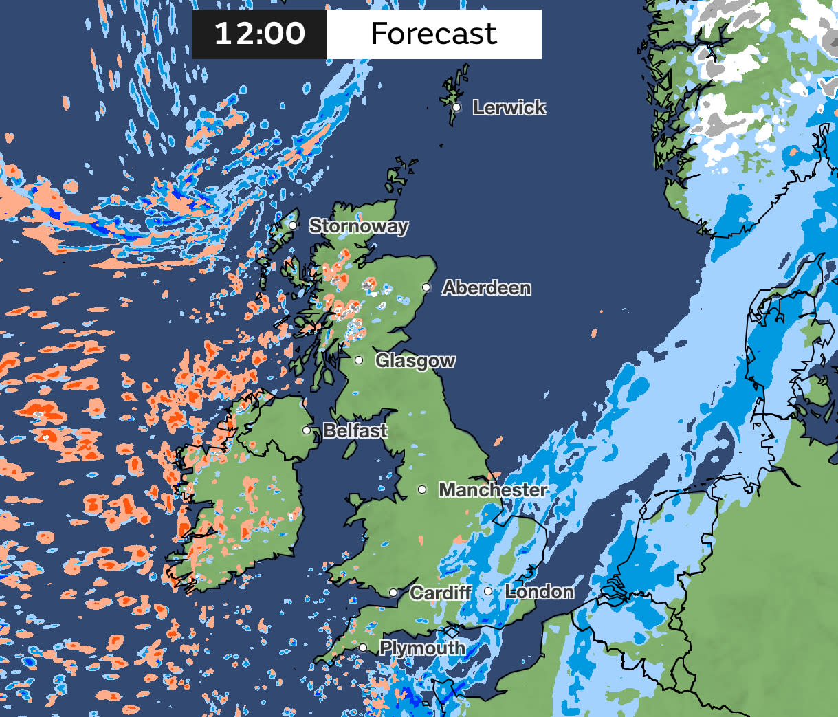
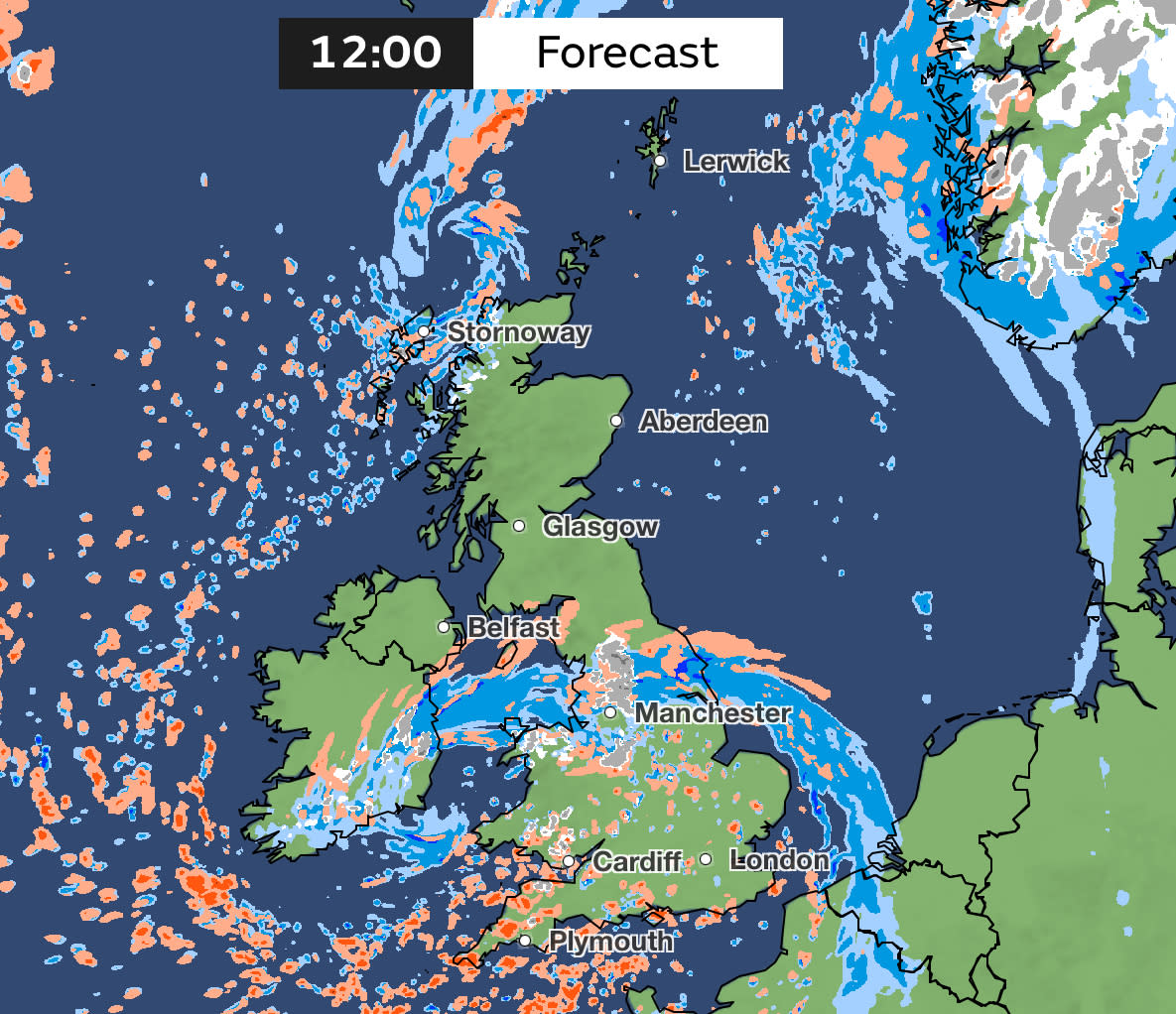
Rain is starting to fall across south-east England, with the wet weather set to continue for much of the day. But further north there will be blustery showers that could turn wintry – bringing icy conditions with it.
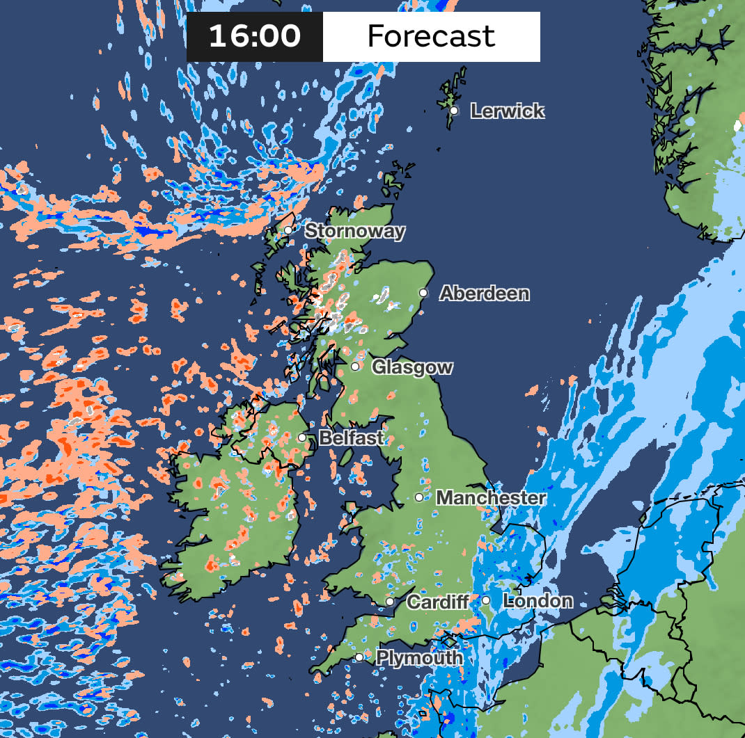
The north and west of Scotland will feel the colder conditions particularly on Thursday, according to the Met Office. The forecaster said showers will be felt “from the word go”, before heavy winds arrive and bring temperatures down to single figures.
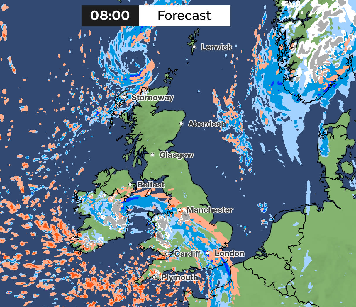
A low pressure is set to sweep in overnight, bringing with it rain and snow across the Welsh mountains on Friday morning. Met Office forecaster Claire Nasir said “tricky driving condition” should be expected across the southern counties as commuters set out tomorrow.
Weather maps show that hail could fall in parts of England and Wales on Friday morning. More hail could also be felt in some southern and south-eastern parts of England on Friday evening.
The Met Office said unsettled weather will stick around for the weekend, with showers and gales predicted. Temperatures will be “nearer to or a little below the seasonal average” for the time of the year, the forecaster added.
Yahoo breaks down what the weather will be like for each region of the UK.
London and the South-East
Thursday
Rain becoming persistent and lasting most of the day with some heavy outbreaks. Maximum temperature 11C.
Friday
Increasing wind and rain in the morning with some wintry flurries possible in heavier bursts of rain. Maximum temperature 6C.
South-West
Thursday
A wet morning will start to dry up by the afternoon. Brighter in the west but showers still possible. Feeling colder and blustery by the evening. Maximum temperature 9C.
Friday
Bright and sunny spells but with some heavy downpours. Hail and thunder possible with some snow over the hills. Feeling cold in the blustery winds. Maximum temperature 7C.
Midlands
Thursday
Rain and cloud clearing in the East Midlands. Brighter spells with showers in the afternoon, perhaps wintry. Maximum temperature 9C.
Showery rain and cloudy in the West Midlands. Brighter with showers later. Light winds but feeling chilly. Maximum temperature 8C.
Friday
Mist and fog clearing as wind and cloud arrive in the morning in the East Midlands. Some wintry rain expected. Maximum temperature 6C.
Wet with wintry rain in the West Midlands but snow mostly over higher ground. Drier with sunny spells and showers in the afternoon. Breezy and cold. Maximum temperature 6C.
North-East
Thursday
A bright start with hazy sunshine. Isolated showers in the afternoon, wintry over the hills. Maximum temperature 9C.
Friday
A bright start before cloud and rain spread through the morning. Some snow possible over the hills. Becoming breezy. Maximum temperature 6C.
☔ A mild but wet start to Thursday in the southeast as rain lingers
🌦️ Colder yet brighter in the northwest with a mixture of sunny spells and blustery showers, falling as snow over higher ground
🌬️ Severe coastal gales will affect the far north of Scotland pic.twitter.com/qxBzVPrD7L— Met Office (@metoffice) February 28, 2024
North-West
Thursday
Generally dry and cloudy before brightening up in the afternoon, with some late showers possible. Feeling colder. Maximum temperature 8C.
Friday
Breezy with rain and snow during the morning. Drier conditions later and winds easing. Maximum temperature 6C.
Scotland
Thursday
Cold and bright with scattered showers, wintry in the north and west. Mainly dry in the east. Mainly dry and sunny at the borders. Maximum temperature 7C.
Friday
Dry and cold with some brightness. Rain and snow spreading to the east by the evening. Maximum temperature 6C.
Northern Ireland
Thursday
Some bright spells and scattered showers, becoming more widespread an wintry through the afternoon. Maximum temperature 8C.
Friday
Rain and snow across the south at first. Otherwise cold and dry with some brightness. Maximum temperature 7C.
Wales
Thursday
Cloudy with some showery rain. Brighter with blustery showers later. Light winds but feeling chilly. Maximum temperature 9C.
Friday
Rain and snow clearing throughout the morning. Bright spells and scattered heavy and wintry showers for the rest of the day, Breezy and cold. Maximum temperature 7C.

