
How likely is another La Niña for Australia in 2024?
Eastern Australia is enduring a relatively wet and, in some regions, mild summer, belying expectations an El Niño event in the Pacific would mean a dry, hot season. Some are even forecasting a La Niña may return for the fourth year in five.
How likely is another La Niña so soon and what are the challenges facing forecasters? But first, a summary of where we are now.
Did BoM get it wrong?
The Bureau of Meteorology in September joined other global weather agencies to declare an El Niño event to be under way in the Pacific. Then widespread, and in some cases flooding, rains arrived in December.
The bureau’s website makes it clear El Niños “usually” reduce rainfall across the eastern and northern parts of the continent. It’s not a certainty.
And the shift in rainfall away from the western Pacific that marks El Niño years has its main influence on Australia “through winter-spring”. So it’s not a summer-centric event.
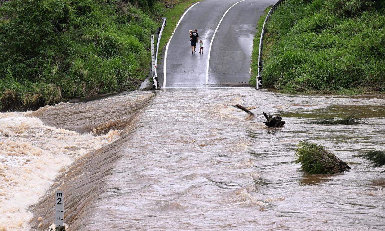
So how did spring go? Australia had its driest September on record, with eastern Australia registering barely a quarter of its average rain at just 7.39mm. October wasn’t much better, coming in at the fifth-least rainfall for that month before November falls improved but spring rainfall was still 20% below the 1961-90 average. (August to October was also the driest three-month period ever recorded by the bureau.)
Related: El Niño may push heating past 1.5C but urgent action could avert catastrophe
How the El Niño southern oscillation works
As the word “oscillation” suggests, conditions across the Pacific tend to see-saw. During an El Niño, there’s extensive warming in the central and eastern equatorial regions, drawing moisture away from Australia.
During neutral years, strong winds blow eastwards, drawing cool waters from the northward-flowing Humbolt current to the surface of the eastern Pacific. As the western Pacific doesn’t have a similarly cool current, the ocean surface temperature difference between the west and the east can be 8C-10C, the bureau says.
“[D]uring El Niño years, the trade winds weaken and the central and eastern tropical Pacific warms up,” it says. “This change in ocean temperature sees a shift in cloudiness and rainfall from the western to the central tropical Pacific Ocean.”
For La Niñas, the heat buildup is in the western Pacific as the trade winds strengthen bringing more convection and favouring wetter-than-usual conditions. The three consecutive La Niña events between 2020-21 and 2022-23 were notably wet years for Australia.
Can we predict a La Niña – or El Niño – for 2024?
Chatter about a possible La Niña after the current El Niño was sparked in part by the US National Oceanic and Atmospheric Administration publishing models showing the event breaking down by March to May.
“There are also increasing odds of La Niña in the seasons after a shift to ENSO-neutral,” NOAA said in an update earlier this month.
Australia’s Bureau of Meteorology’s own model, though, leans towards El Niño-like conditions lasting until June at least. “At this stage it is too soon to forecast a La Niña event in 2024,” a bureau spokesperson told Guardian Australia.
Since 1900, half of the years have featured either a La Niña or an El Niño, and there’s about a 40-50% chance that an El Niño will be followed by a La Niña, the person said.
Wenju Cai, a leading CSIRO researcher before his recent retirement, says that there have been La Niñas and El Niño years after each other.
However, “I don’t see any analogy in history – of three La Niñas, an El Niño then switching to another La Niña,” Cai said. “If I had to flip a coin, I’d predict an El Niño” for 2024.
Agus Santoso, director of the China-based CLIVAR centre studying climate ocean variability, said there is “still uncertainty” how 2024 will play out but a return of La Niña can’t be ruled out.
“The chance of a La Niña tends to be higher when we have an El Niño the year before, especially a strong one,” Santoso said. “That is because a strong El Niño tends to leave the upper equatorial Pacific Ocean to be deficit of heat, which is favourable for La Niña to develop.”
Why is there a ‘predictability barrier’?
Longer-range weather models don’t have the same year-round accuracy because of what’s known as the “predictability barrier” that runs roughly February to May.
That’s when the temperature difference, or gradient, naturally diminishes across the tropical Pacific. “Model outlooks for predictions through autumn and beyond should therefore be treated with caution,” the bureau’s spokesperson said.
Cai agrees that model confidence is “poor” during autumn when trade winds are typically “very weak”. “The whole thing is full of noise,” he says.
Related: Experts warned El Niño was likely to bring Australia a hot, dry summer. What happened?
By contrast, trade winds usually pick up during June, July and August, and so it’s clearer to see whether they are stronger or weaker than normal. By September and October, it’s “the growth season for La Niñas and El Niños” and such events are “easily predicted” because they already evident to those monitoring, Cai said.
Artificial intelligence may help improve forecasts in the future if machines are better able to detect interactions between, say, the Atlantic and Pacific, than conventional models.
However, machine learning relies on the same observational data, and so “the barrier is always there”, Cai said.
And as for climate change, work by Cai and others has pointed to an increase in more extreme El Niños and La Niñas as the planet heats up.
“The impact of La Niña may be stronger in the backdrop of the higher atmospheric moisture,” Santoso said. “On the other hand, a warming air as we expect to have in the future can exacerbate the impact of El Niño.”
That’s one forecast we hope doesn’t eventuate.

