
Incredible satellite image shows lava spewing from Iceland volcano
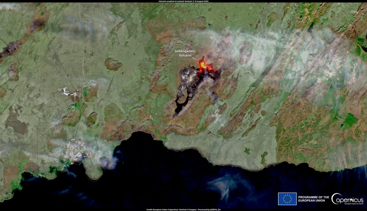
An incredible satellite image has shown lava and smoke spewing from a volcano in Iceland after its second eruption in 6,000 years.
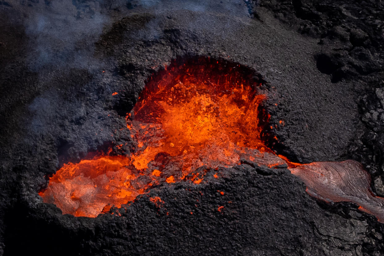
The volcano erupted on Fagradalsfjall mountain near the capital Reykjavik after days of rising earthquake activity on 3 August.
The mountain also saw an eruption last year which lasted six months.
A new image from the European Commission’s Directorate-General for Defence Industry and Space (DEFIS) showed what it looked like from space.
Watch: Red lava spews from Iceland volcano eruption at night
The @defis_eu account tweeted: “On 3 August, an eruptive phase started in the Reykjanes peninsula, #Iceland.
“The eruption started in an uninhabited valley but could threaten local infrastructure soon
“The lava flow is visible in the #Sentinel2 image of 15 August.”
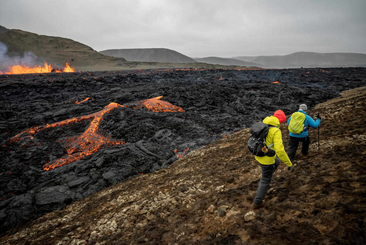
Tourists and residents were told to avoid the area due to poisonous gases after the explosion, although there was no immediate risk of damage to critical infrastructure, the Department of Civil Protection and Emergency Management had said.
A "code red" was declared to prohibit airplanes from flying over the site, although helicopters were sent in to survey the situation.
Read more: Spectators flock to dramatic volcanic eruption in Iceland

But scientists are now worried the eruption could destroy nearby infrastructure due to rising lava in the valley of Merardalir.
If the lava flows south once it goes over the brim, it may hit a local road within a fortnight.
Geophysicist Magnús Tumi Guðmundsson told Icelandic outlet mbl.is: "The lava had not passed the edge of the pass, but if the flow continues like it has been doing, it will eventually go over the brim.
“There is a possibility the route might be different in what routes the lava will flow into the valleys.”
The Reykjanes Peninsula is a volcanic and seismic hot spot, and the outbreak occurred just 25 km (15 miles) from Reykjavik and 15 km from the nation's international airport.
Read more: Japan volcano eruption: Citizens evacuated as ‘highest alert’ issued
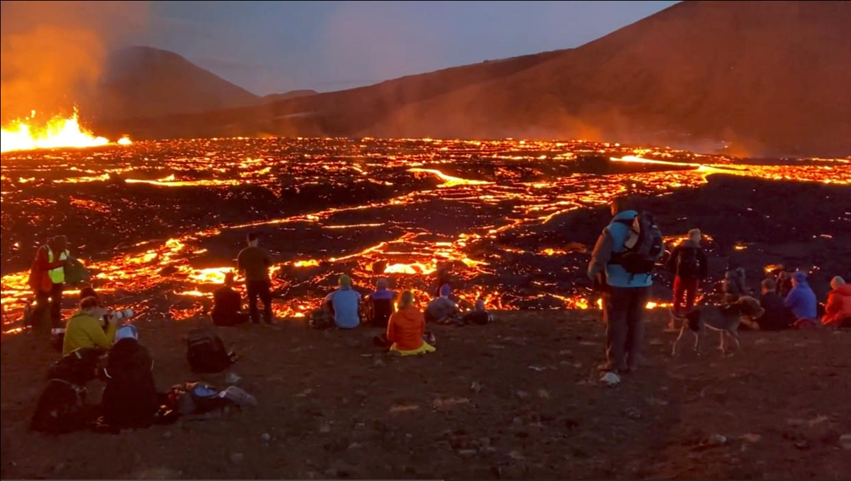
In March last year, lava fountains erupted spectacularly in the area from a fissure 500 to 750 metres (1,640 to 2,460 feet) long, continuing until September and attracting thousands of Icelanders and tourists to the scene.
Unlike the eruption in 2010 of the ice-covered Eyjafjallajokull volcano, which halted some 100,000 flights and forced hundreds of Icelanders from their homes, this eruption is not expected to spew much ash or smoke into the atmosphere.
Located between the Eurasian and the North American tectonic plates, among the largest on the planet, Iceland frequently experiences earthquakes and has high volcanic activity as the two plates move in opposite directions.

