
Disaster assistance activated as Sydney ‘blue sky flood’ continues to threaten homes
Hundreds of residents in Sydney’s north-west have been ordered to flee their homes after heavy rain caused flooding in the Hawkesbury-Nepean River catchment.
The New South Wales government has announced assistance measures after heavy rain on Friday and Saturday prompted authorities to open the spill gates at Warragamba Dam.
Evacuation orders remain in place for several towns and suburbs along the Hawkesbury, including parts of Agnes Banks, Freemans Reach, north of Bligh Park and the western Richmond Lowlands.
Related: Man’s body found in flood water in western Sydney
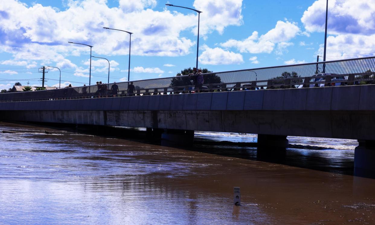
Blue skies reappeared over Sydney on Sunday, but about 350 homes – with about 960 residents – were still subject to the evacuation orders.
The NSW emergency services minister, Jihad Dib, said on Sunday the NSW State Emergency Service had also rescued about 200 people from flood waters since Friday.
“It’s fairly blue skies behind me, but that doesn’t mean that the water danger is over, that the threat of flood is over,” Dib said.
“As we talked about yesterday, there’s a thing called the blue sky flood, where all of the water that feeds from the tributaries into the local catchment areas basically comes together.”
The SES said 2,700 homes had been subject to evacuation orders during Friday and Saturday, but that most had been able to return on Sunday.
The SES commissioner, Carlene York, said there were “still a lot of roads cut and there’s still a lot of danger out there”.
“What we’re moving to today is to assess the damage at those different communities across the state that have been affected by this significant weather event,” she said.
“And as soon as it’s safe, we will be lifting those evacuation orders so that people can go into their houses and start cleaning up all their properties.”
York warned people to remain cautious, particularly after dark, while flood waters remained high and roads were closed.
“We’ve had way too many rescues required to go and assist people to get out of those flood waters, and there’s been a lot of vision of people being on the roofs of their cars and some really dangerous situations where my SES volunteers have been placed in danger,” she said.
The federal and NSW governments announced on Sunday that disaster assistance funding would be made available to flood-affected residents in the Blue Mountains, Camden, Hawkesbury, Kiama, Liverpool, Penrith, Shellharbour, Shoalhaven, Sutherland, Upper Lachlan, Wingecarribee, Wollondilly and Wollongong local government areas.
“Work to assess the impact of flooding across the state is being conducted as quickly as possible, with disaster declarations like these a crucial first step in unlocking assistance,” Dib, said.
“The SES has continued to work throughout the night to reach out to communities and I’m confident that with the work they’ve been doing, that we are being incredibly proactive.”
The rain on Friday and Saturday earlier caused landslips, flash flooding and a house in Wollongong to be swept into a creek. Investigations on Sunday will also continue into the death of a man found in water in Penrith.
While the threat appears to have eased, communities on Sydney’s fringes will be nervously watching river levels on Sunday.
Further river rises and moderate to major flooding is expected along the Hawkesbury River on Sunday, after the week ended with 200mm across much of the catchment.
The river was expected to peak above the major flooding level at North Richmond on Sunday morning, albeit 2 metres below the peaks reached in major floods in 2021 and 2022.
More than 107 warnings were in place late on Saturday night, with 32 emergency alerts still in place on Sunday morning.
Cloudy conditions and scattered showers are forecast for the hardest-hit areas on Sunday, including Sydney and Wollongong.
The weather system’s final hurrah was expected to hit the north-east of the state, as the coastal trough brought thunderstorms, possibly severe, on Sunday.
Meanwhile, heavy rain is expected to drench parts of Queensland on Sunday, with up to 200mm tipped to fall in the south-east of the state.
A major flood warning is in place for Warrego River in the state’s south-west.
Flood warnings are also in place for Eyre Creek, Weir River, Balonne River, Moonie River and Norman River.
Both the Nindooinbah and Moogerah dams, more than 100km west of the Gold Coast, have started spilling excess water.

