
Maps show flood and weather warnings to hit parts of UK
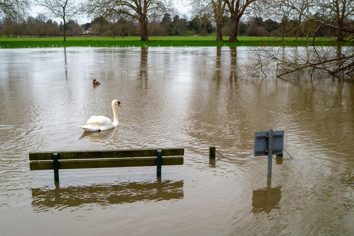
Significant rain is returning to large parts of the UK, sparking fresh flood warnings.
The Environment Agency currently has 14 flood warnings – where flooding is expected – in place for parts of England. Homes near the River Great Ouse, the River Derwent, the River Severn and the River Thames are among those that could be affected by the heavy and persistent rain.
Meanwhile, there are another 108 flood alerts – where flooding is possible – also in place. These include areas such as Kent, Bristol and Cambridgeshire. The full list can be seen on the Environment Agency website.
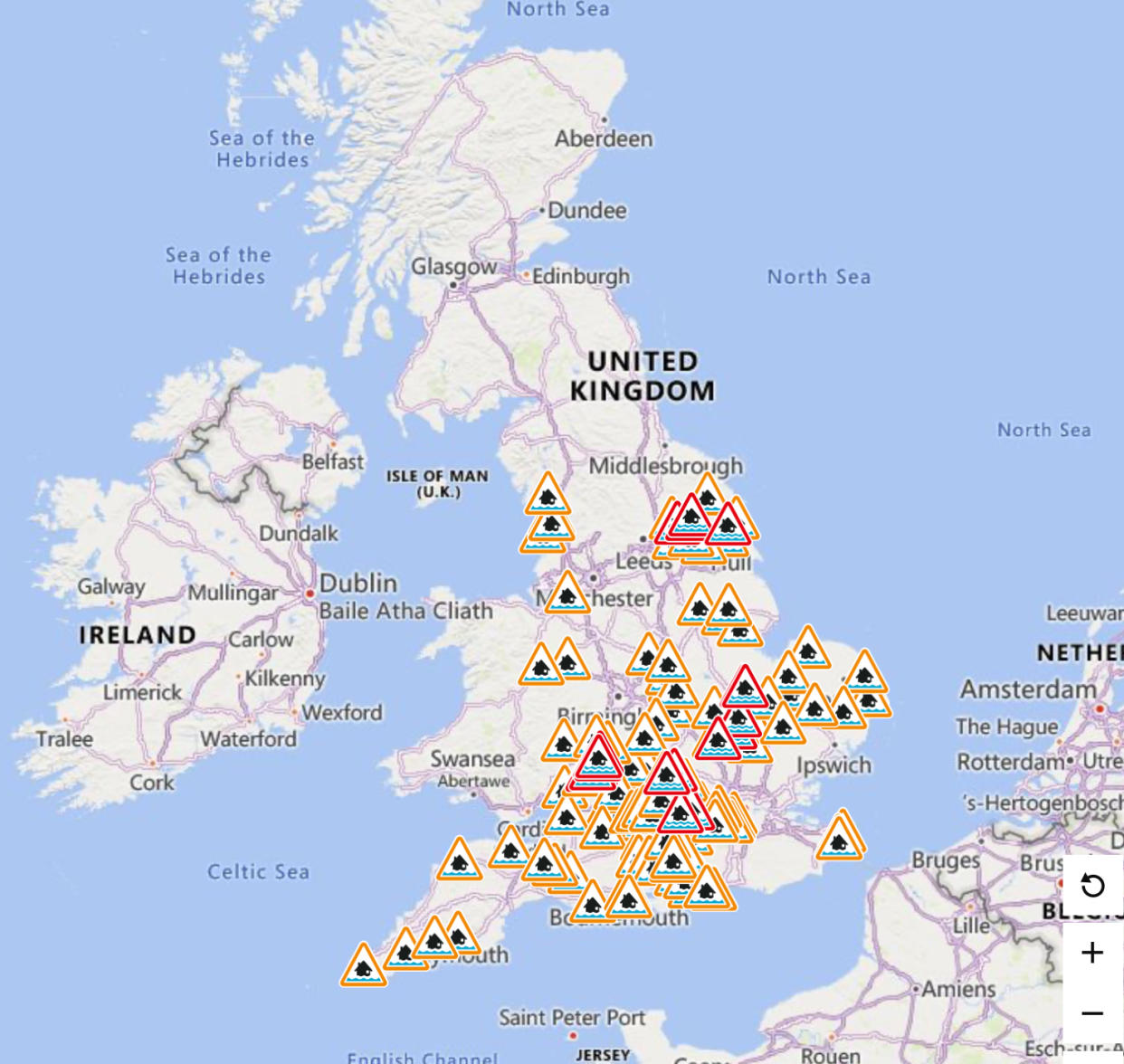
The Environment Agency warned residents in flood warning zones to avoid walking, cycling or driving through flood water while the alerts are in place.
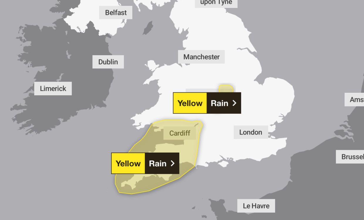
The Met Office has now issued a yellow warning for rain in southwest England and southern Wales on Thursday. The warning is in place from 11am on Thursday morning until midnight. A yellow warning for rain is also in place in parts of Leicester and Coventry from 2pm on Thursday afternoon until 3am on Friday morning.
The forecaster says that bus and train services are likely to be affected by the rain, with journey times taking longer. They also warn of spray and flooding on the roads – which will also likely add time to journeys.
⚠️ Yellow weather warning issued ⚠️
Rain across the English Midlands
Thursday 1400 – Friday 0300
Latest info 👉 https://t.co/QwDLMfRBfs
Stay #WeatherAware⚠️ pic.twitter.com/joBItOpGXY— Met Office (@metoffice) February 14, 2024
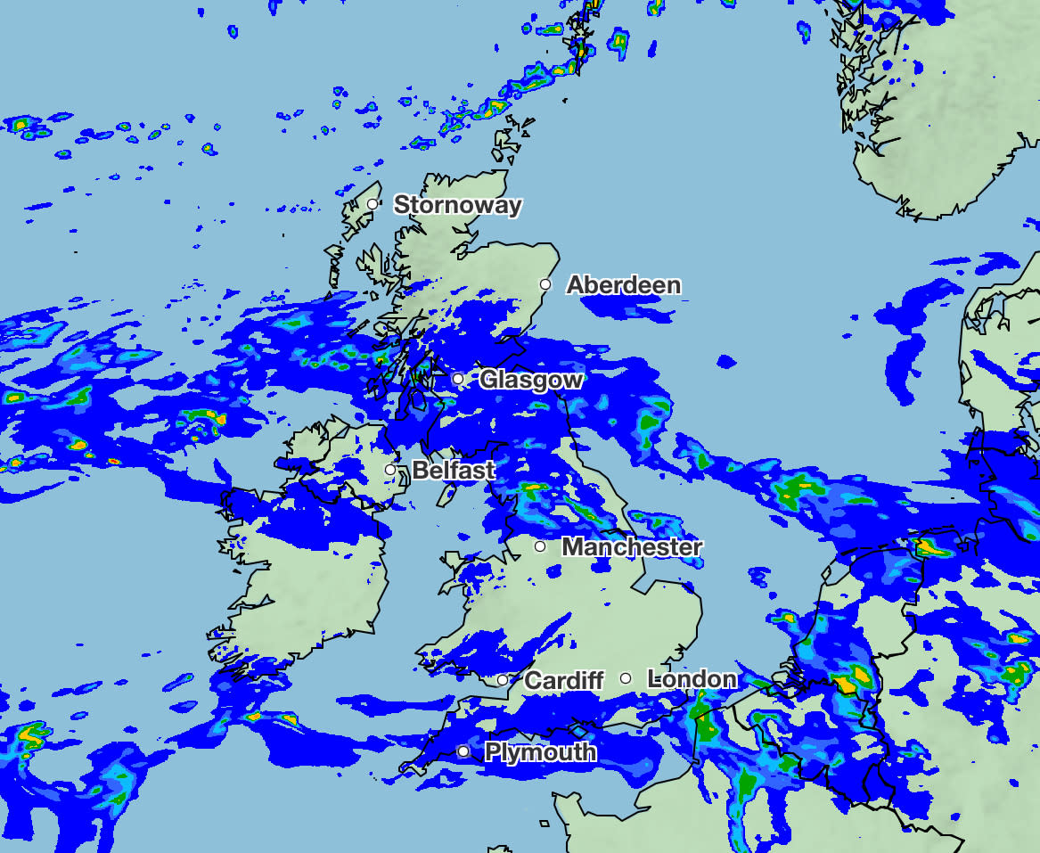
Heavy and persistent rain is most likely to be feels in the west on Thursday, while southeast England will see bright and sunny spells with mild temperatures.
Last week saw snow and ice warnings for parts of the UK, with flood warnings and alerts also in place. The south and Midlands were the areas mostly affected by the flooding risk. A total of 43.2mm of rainfall was measured in Harbertonford, south Devon, last Thursday – almost half the average for the area in February. Disruption was also reported by Great Western Railway on the line between Bath and Swindon due to flooding.
Read more: Flood alert remains in place as rain continues to fall (Dorset Echo)
Yahoo breaks down what the weather will be like for each region of the UK.
London and the South-East
Wednesday
Cloudy with outbreaks of rain and drizzle. Some brighter spells in the afternoon. Remaining mild. Maximum temperature 14C.
Thursday
Cloudy with some isolated showers along the coast. Heavy rain overnight. Maximum temperature 15C.
South-West
Wednesday
Cloudy with outbreaks of persistent rain in the morning. More intermittent in the afternoon with some bright spells. Maximum temperature 15C.
Thursday
Largely dry and bright at the start of the day before thicker cloud and heavy and persistent rain in the afternoon. Maximum temperature 15C.
Midlands
Wednesday
Outbreaks of rain and drizzle in the morning in the East Midlands. Possible dry spells in the afternoon before rain returning in the evening. Maximum temperature 13C.
Rain and drizzle in the West Midlands with some sunshine developing. Very mild for the time of year. Maximum temperature 15C.
Thursday
Rain will clear to drier spells in the East Midlands. Remaining cloudy with more rain in the afternoon. Maximum temperature 14C.
The West Midlands will see dry and bright spells before rain returning in the afternoon. Maximum temperature 15C.
North-East
Wednesday
Damp and overcast with outbreaks of rain and drizzle, occasionally heavy. Mild with light winds. Maximum temperature 12C.
Thursday
Outbreaks of rain in the morning with some drier spells possible. Heavy rain in the afternoon. Maximum temperature 12C.
North-West
Wednesday
Cloudy with outbreaks of heavy and persistent rain, especially in the north. Feeling mild. Maximum temperature 13C.
Thursday
Cloudy and wet with heavy rain in the morning. Easing slowly in the afternoon. Maximum temperature 14C.
Scotland
Wednesday
Dry with some brightness and outbreaks of rain. Maximum temperature 7C.
Thursday
Mostly cloudy with drier weather developing. Mild with some mist. Maximum temperature 5C.
Northern Ireland
Wednesday
Cloudy with outbreaks of rain. Dry and cloudy by the afternoon with some light showers. Maximum temperature 12C.
Thursday
Some persistent rain possible but otherwise cloudy and mainly dry. Maximum temperature 12C.
Wales
Wednesday
Cloudy with outbreaks of rain and drizzle, turning heavy at times. Some bright spells. Maximum temperature 14C.
Thursday
Drier for a time with some bright spells. Wet weather returning by lunchtime. Maximum temperature 15C.

