
Maps show areas where rain will be heaviest ahead of 'washout' UK weekend
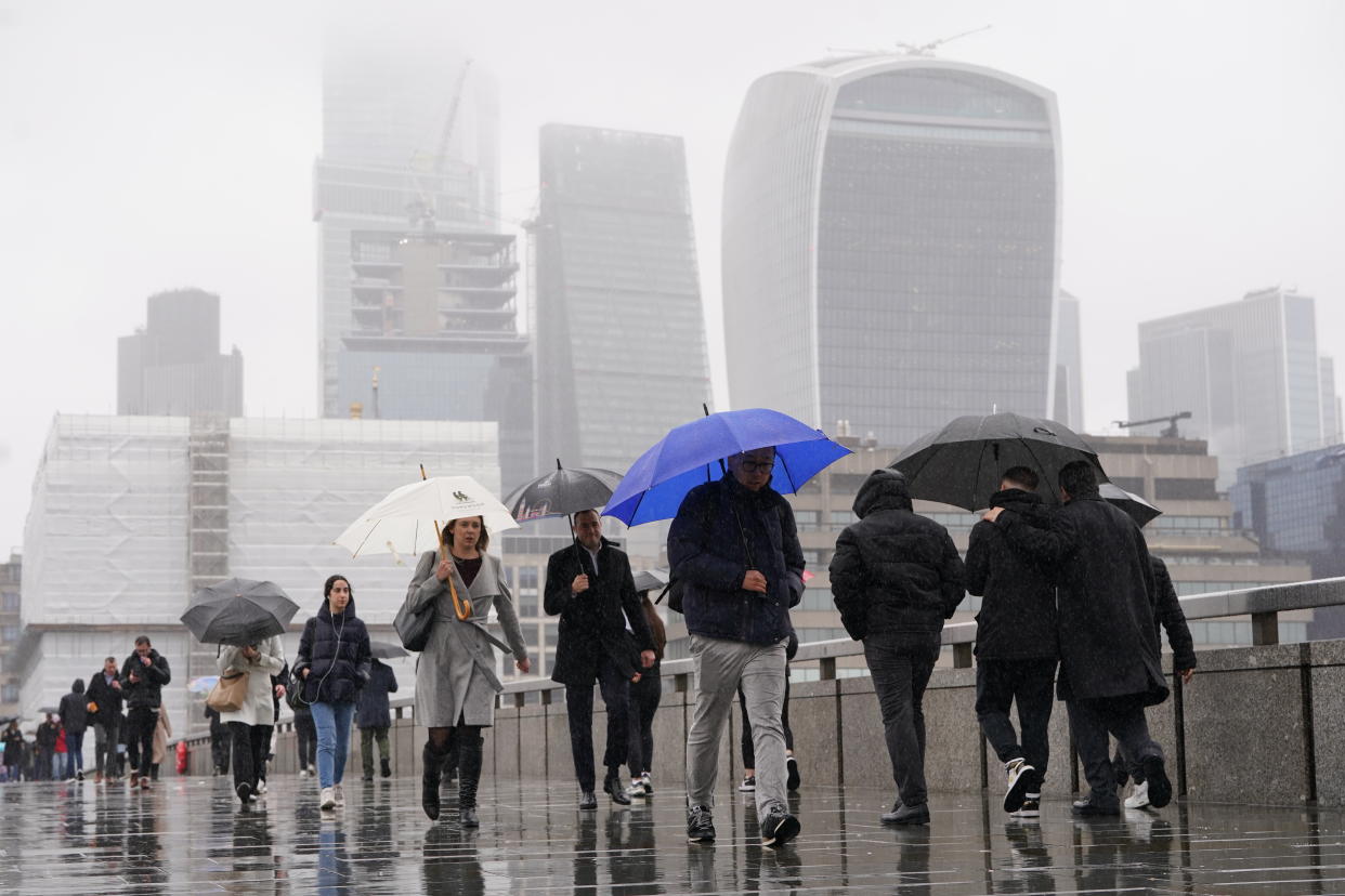
More heavy rain is forecast for much of the country into the weekend, following days of unsettled weather.
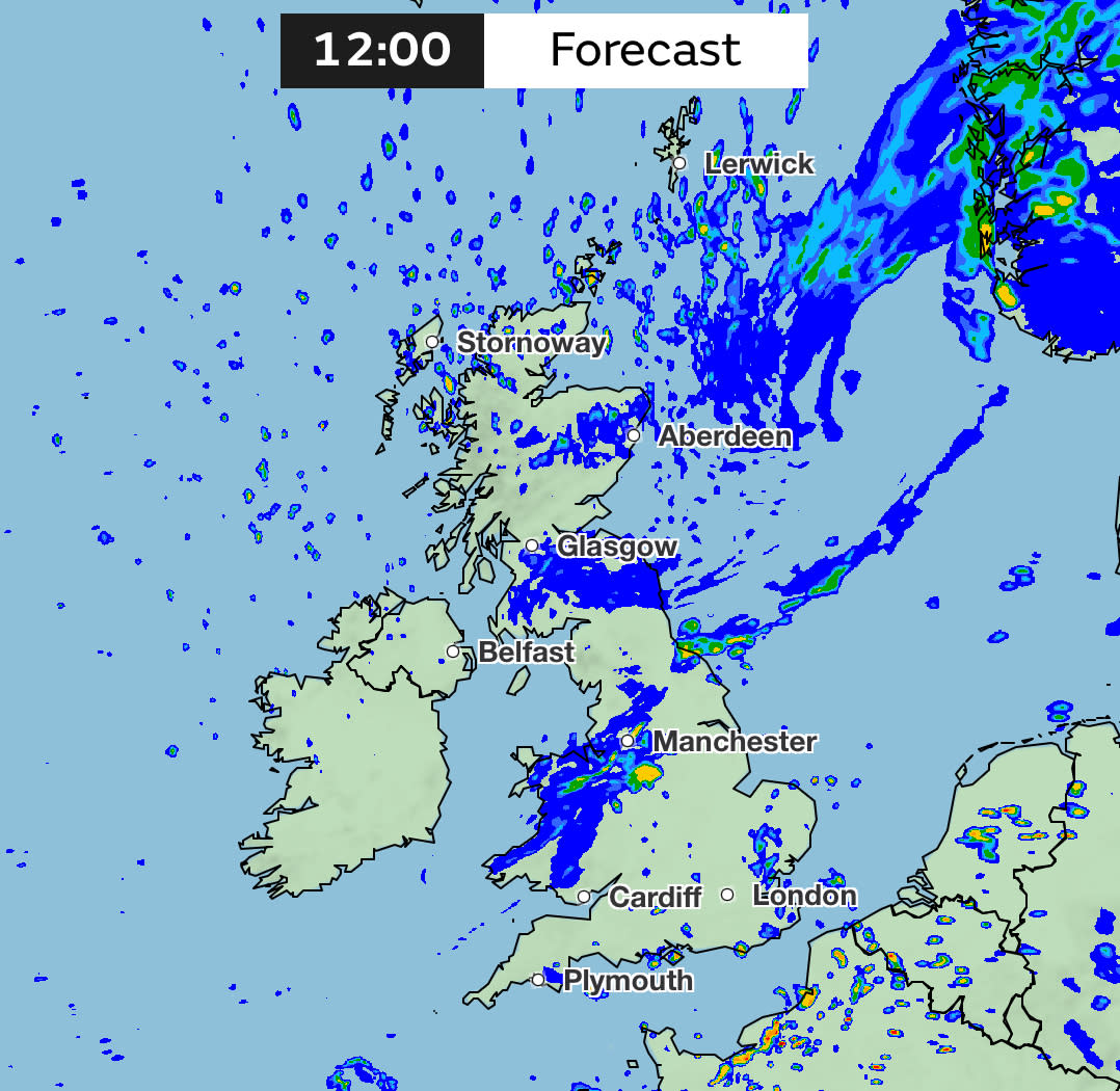
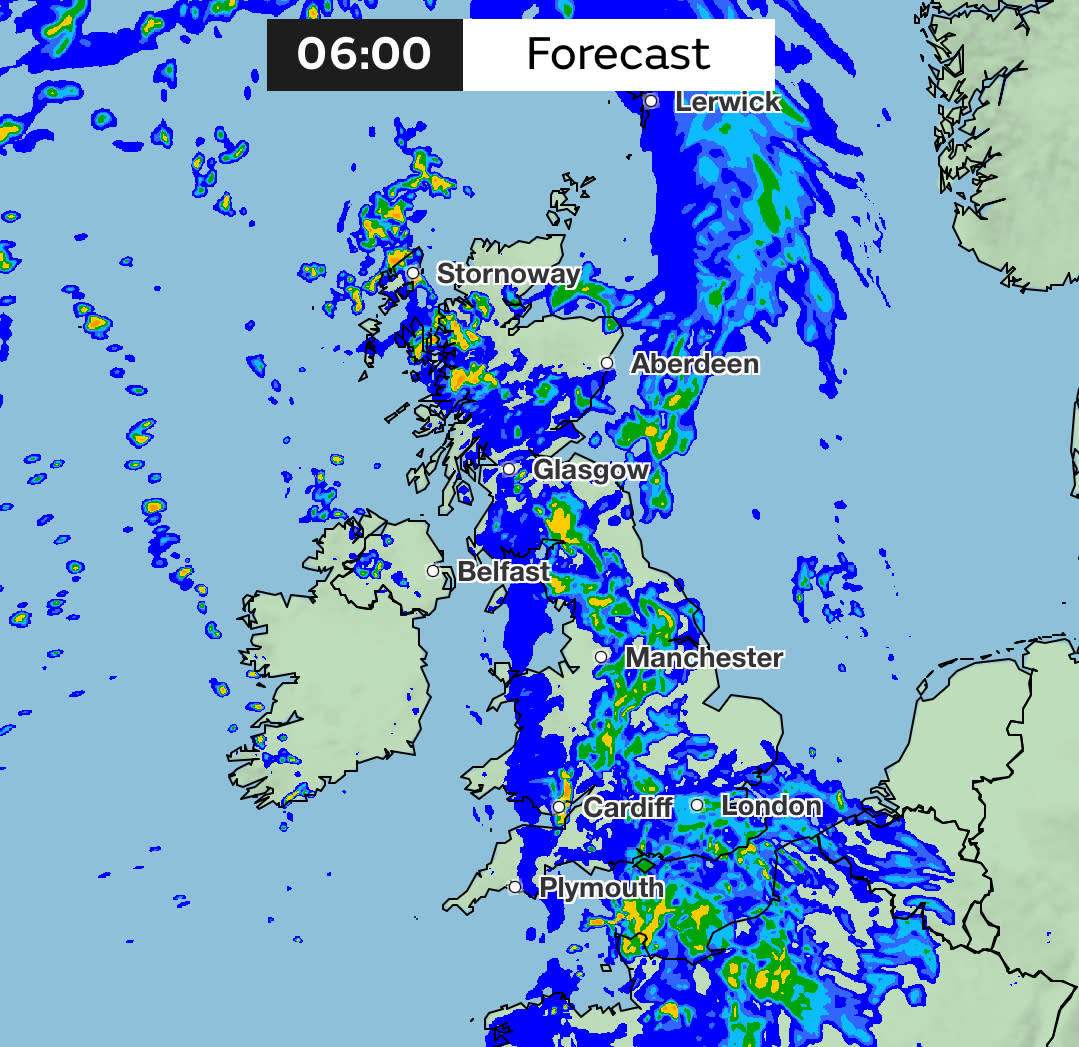
Tuesday saw a deluge of rainfall hitting large parts of the country. However, while some areas were drier on Wednesday morning, the Met Office warned that there is more wet weather to come – with much of the country covered by rain on Sunday morning.
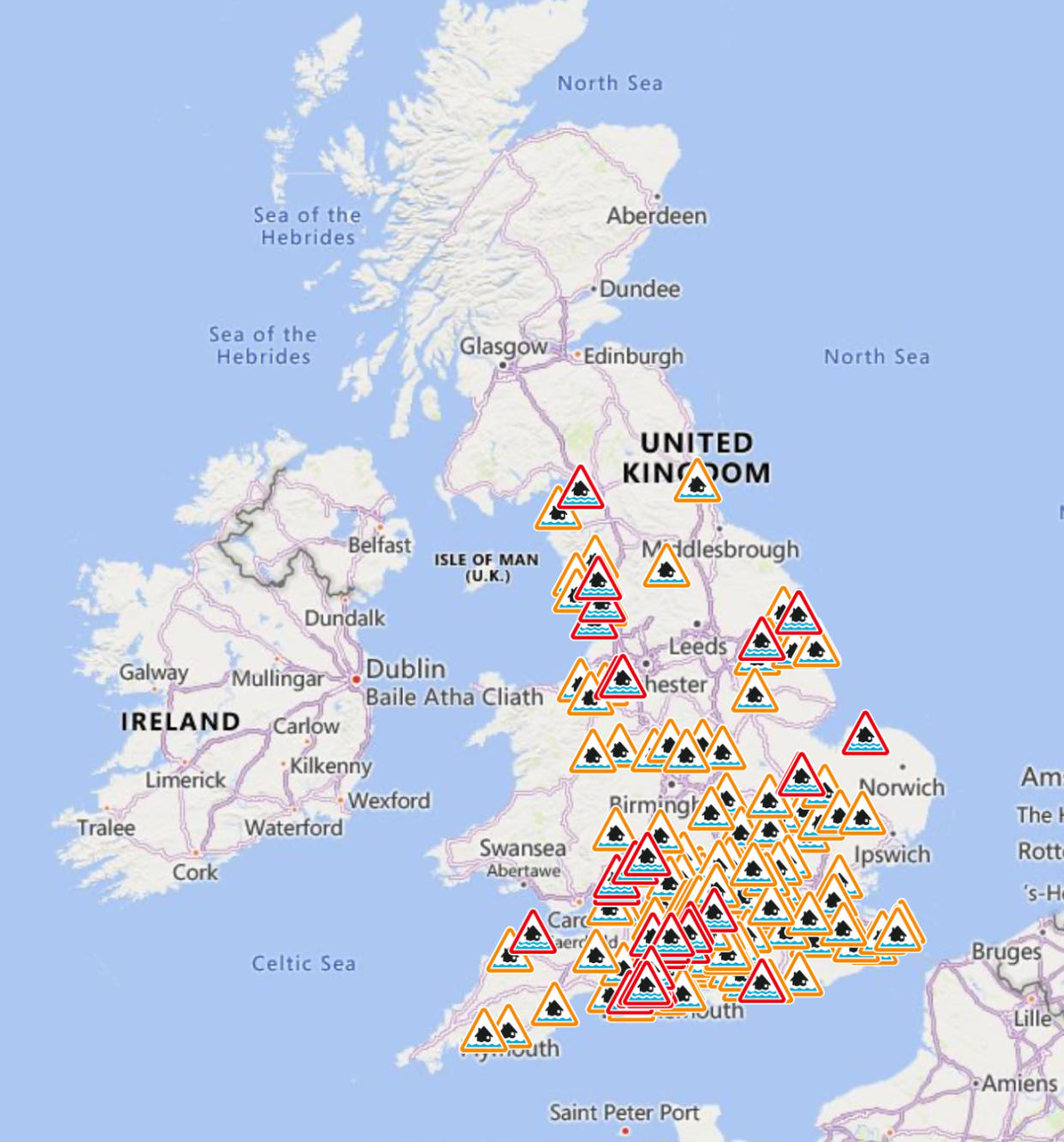
The Environment Agency also issued 36 flood warnings – where flooding is expected – on Wednesday, with another 151 flood alerts – where flooding is possible – also in place.
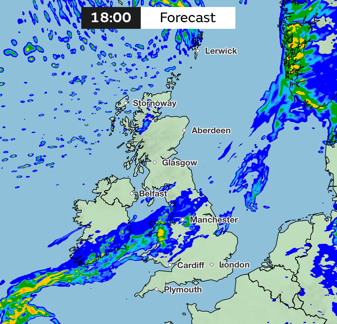
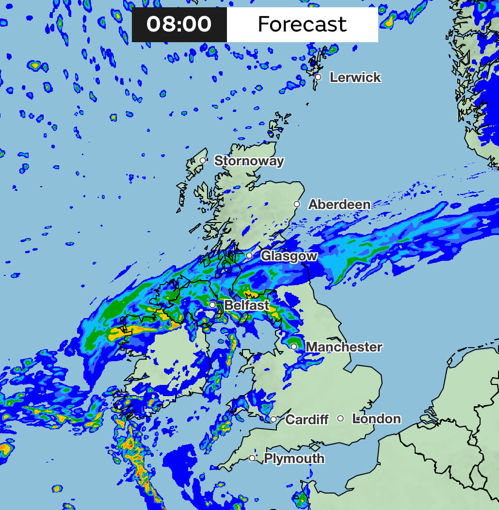
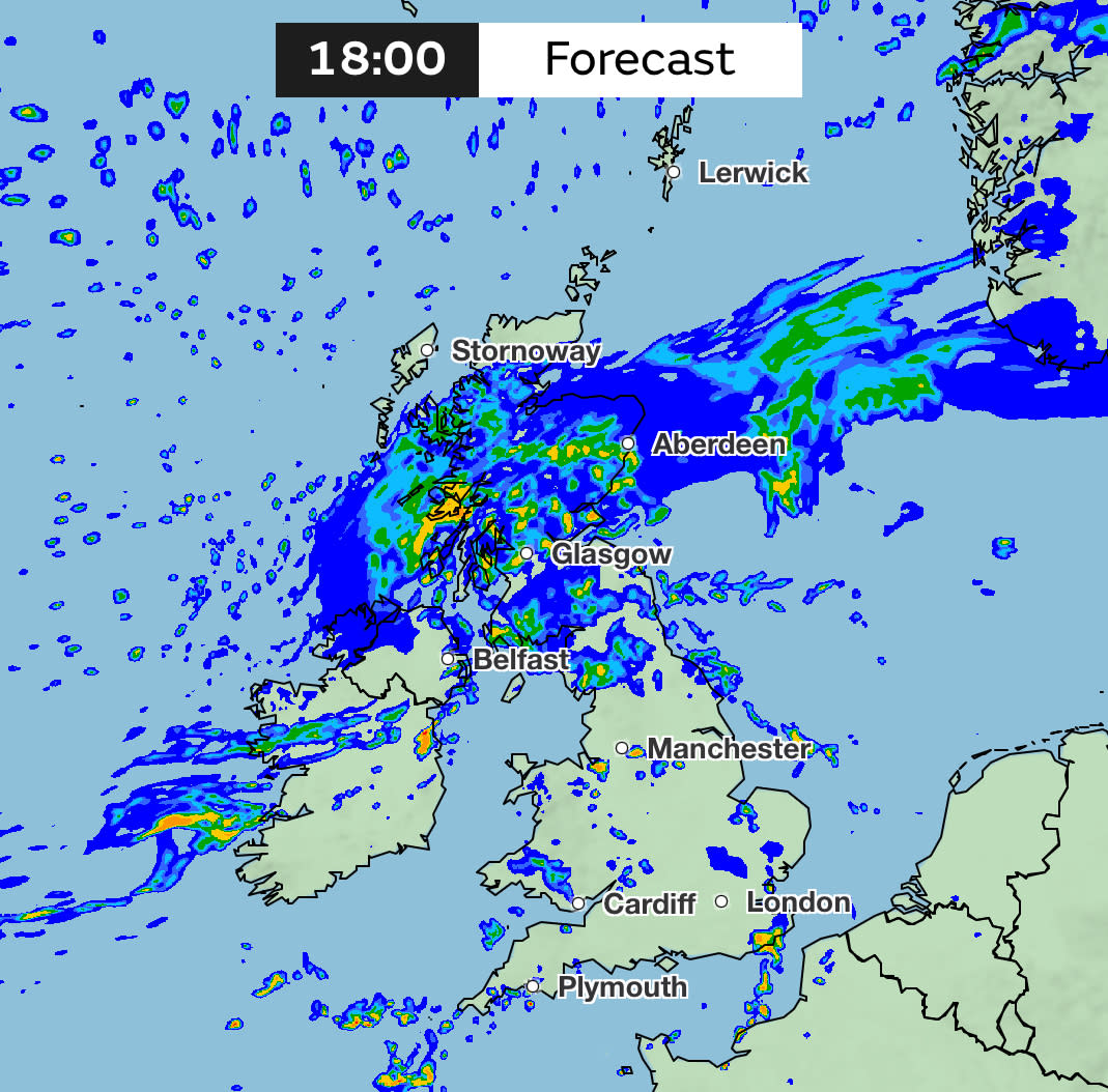
The Met Office predicted rain moving slowly across northern parts of the UK throughout Wednesday, before moving north across Scotland on Thursday. Showers or longer spells of rain were expected over the weekend, with weather maps showing rainfall covering large parts of the UK on Sunday morning, before heading east to leave a drier day.
Met Office meteorologist Clare Nasir said rain would continue "to bother northern England, and northern parts of Wales, through Wednesday evening and overnight”. She added: “Some heavier pulses can’t be ruled out as it slowly nudges in across southern counties of Scotland, pushing across Northern Ireland as well… It’s pretty much showery wherever you are.”
Read more: Exceptional rainfall causes council staff to abandon outdoor works (Dorset Echo)


Yahoo breaks down what the weather will be like for each region of the UK.
London and the South East
Wednesday
Largely dry and cloudy with some sunny spells. Possible light rain and drizzle. Windy and mild. Maximum temperature 14C.
Thursday
Largely dry with some sunny spells. Turning closures with some heavy rain showers by the evening. Mild. Maximum temperature 15C.
Friday to Sunday
Sunny spells with some thundery showers on Friday. Dry with some rain on Saturday, rain clearing to showers on Sunday.
South West
Wednesday
Largely dry but cloudy. Some patchy rain along the coasts. Bright and sunny spells possible in the east. Staying breezy but mild. Maximum temperature 14C.
Thursday
Showery rain, sometimes turning heavy. Sone drier spells in between. Breezy at the coasts. Maximum temperature 15C.
Friday to Sunday
Sunshine and blustery showers on Friday. Dry start on Saturday followed by more rain. Breezy and above average temperatures.
Midlands
Wednesday
Mostly cloudy in the East Midlands with some sunny spells developing. Largely dry with some rain possible. Maximum temperature 13C.
Largely dry with patchy rain and drizzle in the West Midlands. Some sunshine possible and staying mild. Maximum temperature 14C.
Thursday
Largely dry in the East Midlands, turning cloudier with some heavy rain by the evening. Maximum temperature 15C.
Showery rain in the West Midlands, turning heavy at times. Some dry spells between showers. Maximum temperature 15C.
Friday to Sunday
Sunny spells with heavy rain on Friday in the East Midlands, more rain on Saturday and Sunday before clearing to showers.
Sunshine and blustery showers in the West Midlands on Friday, with more rain on Saturday and Sunday.
North East
Wednesday
Some heavy rain, which will linger throughout the day. Drier and sunny spells developing. Windy. Maximum temperature 12C.
Thursday
Heavy rain will continue across all parts throughout the day. Breezy and mild. Maximum temperature 13C.
Friday to Sunday
Rain clearing on Friday with heavy rain on Saturday. Rain clearing to showers on Sunday. Mild throughout.
A damp afternoon for much of Wales and northern England 🌧️
Drier elsewhere though blustery showers in the northwest of Scotland where there is a risk of severe gales 🌬️
Very mild in southern and central areas 🌡️ pic.twitter.com/y0do1gpU6P— Met Office (@metoffice) March 13, 2024
North West
Wednesday
Wet with heavy rain expected. Some drier periods in the south. Remaining cloudy. Maximum temperature 13C.
Thursday
Persistent rain with heavy and blustery showers in the afternoon. Maximum temperature 14C.
Friday to Sunday
Sunshine and blustery showers on Friday, further rain on Saturday and showers on Sunday.
Scotland
Wednesday
Cloudy but largely dry with some sunshine. Strong winds in the afternoon. Maximum temperature 9C.
Thursday
Cloudy with outbreaks of rain and drizzle. Cold. Maximum temperature 7C.
Friday to Sunday
A mixture of dry spells and rain on Friday and Saturday. A few showers on Sunday.
Northern Ireland
Wednesday
Mostly dry with some sunny intervals. Maximum temperature 10C.
Thursday
Cloudy with rain and drizzle. Feeling colder. Maximum temperature 10C.
Friday to Sunday
Rain and dry spells on Friday and Saturday with a few showers on Sunday.
Wales
Wednesday
Damp with outbreaks of heavy rain. Remaining cloudy. Mild and breezy. Maximum temperature 14C.
Thursday
Some heavy showers with some dry periods in between. Breezy and mild. Maximum temperature 14C.
Friday to Sunday
Sunshine and showers on Friday and Saturday. Showers on Sunday with above average temperatures.

