
Eight inches of snow and 70mph to hit UK this weekend

Large parts of the UK will be battered by eight inches of snow this weekend as the Met Office warns Britons to expect travel disruption and power cuts.
SEE ALSO: Will La Nina bring "colder-than-normal" winter to Britain?
SEE ALSO: UK set for 'snowiest winter for 27 years'
'Yellow' and 'amber' warnings are in place for snow, ice and wind, while temperatures will plunge to -6C in parts of Scotland and Wales.
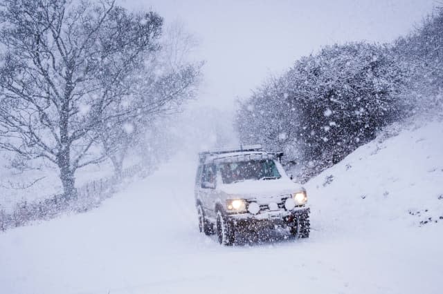
For Saturday, the Met Office says snow showers will continue to affect parts of Scotland, Northern Ireland, Wales, northern England and parts of the Midlands.
Forecasters say that 2 to 5cm of snow is likely in places over the warning area, while 10 to 20cm is possible for some locations, mainly in northern Scotland, Northern Ireland, north Wales and perhaps the northwest Midlands.
Icy surfaces are also likely to be an additional hazard, especially overnight, and the heaviest and most frequent snow showers will progressively become confined to northeast Scotland during Saturday.
The Met Office says: "Impacts include possible travel delays on roads stranding some vehicles and passengers with possible delays and cancellations to rail and air travel.
"Some rural communities could be cut off and power supplies interrupted. Probably some icy stretches on some untreated roads, pavements and cycle paths and also a chance of injuries from slips and falls on icy and snowy surfaces."
For Sunday, a spell of heavy snow is likely over parts of Wales, the Midlands and parts of Northern England.
The Met Office says: "Road, rail and air travel delays are likely, as well as stranding of vehicles and public transport cancellations. There is a good chance that some rural communities could become cut off."

Meanwhile, the chief forecaster at the Met Office says: "A band of rain, heavy at times, is expected to move eastwards over the UK. Ten centimetres looks likely quite widely within the warning area (East Midlands, East of England, London & South East England, North West England, Wales, West Midlands, Yorkshire & Humber), with 15 to 20 cm in places. There is increasing certainty in the track and location of the heaviest snow."
Strong winds are also likely on Sunday and are expected to move east across the far south of the UK. Gusts of 50 mph are likely quite widely, with 60 mph gusts in places and up to 70 mph at times in the most exposed coastal locations.
Visit weather.aol.co.uk for your local forecast.


