
X-ray images reveal how glaciers disappeared from British Isles in last Ice Age

X-ray images have revealed how glaciers disappeared around the British Isles at the end of the last Ice Age - and could provide clues about the impact of melting glaciers in future.
A £3.7 million project surveyed coastal areas around Shetland and the north-west of Scotland, using high-resolution CT scans.
Scientists found the ice sheets spread across Scotland between 20,000 and 16,000 years ago before vanishing, with results showing "striking" similarities to what is now happening in parts of Antarctica.
Dr Tom Bradwell, who led the sampling, said: "This is the first time that we've taken continuous high-quality sediment cores from beneath a former ice stream, in some of the deepest waters around the British Isles, some of which are still uncharted.

"Working on former ice sheets like the one that covered Scotland allows us to view the whole ice-sheet growth and decay cycle, rather than just get a 'snapshot' in time.
"The similarities between what we see happening in West Antarctica today and what we see on the seabed around Scotland are striking."
Radiocarbon dates from shells place the ice sheet margin in the Minch to around 20,000 years ago.
By 16,000 years ago the ice was back on land but by 2,000 years later virtually all the ice in Scotland had melted, according to the British-Chrono research.
As ice shelves around parts of Antarctica have been rapidly decreasing, the scientists hope this research will provide insight as to what impact that will have in future.
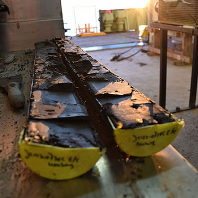
Dr Bradwell and colleagues collected over 200m of cores from the seafloor in the Minch and around Shetland and, since their return in 2015, have been analysing them using a range of techniques.
But it was X-ray technology which provided the clearest clues as to when and why the ice receded around Scotland.
The high-resolution CT scans revealed micro-fine layers of mud, silt and sand that settled out of meltwater from the front of an enormous, partly floating glacier which once filled the Minch.
Zebra-like downcore stripes are occasionally interrupted by large isolated pebbles or thick gravelly layers, dropped by huge icebergs breaking off the front of the ice sheet.
Dr Bradwell, a lecturer at the University of Stirling, added: "It's vital that we understand how the last British ice sheet grew and the style and rate at which it receded.
"At the moment we see massive ice shelves breaking up around West Antarctica, but we don't know how long this will go on for."
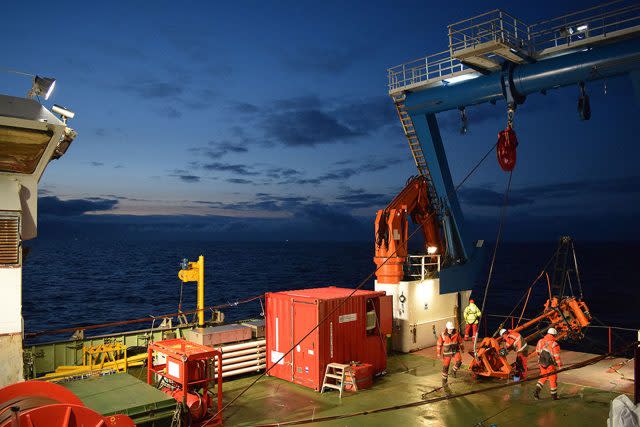
The cores were collected using British Geological Survey's Vibrocorer.
At each site, the machine was lowered from the research ship onto the seabed, where it was kept upright by its legs.
It vibrated its way into the seafloor and penetrated the full length of the core barrel, then retracted and lifted back onto the ship.
The extracts are now stored at British Geological Survey's new cold store facility in the Lyell Centre, Edinburgh.

