
More storms and winds to batter Britain
Britain is set for more bad weather as gales of up to 60mph, wind and rain are set to sweep across the country today (Thursday).
However, a repeat of "tornadoes" which have damaged homes are unlikely, says the Met Office.
Weather alerts for heavy rain and strong gusts in the South West and south Wales today are forecast, and the Met Office says the public should brace itself for potential disruption. Words: Press Association.
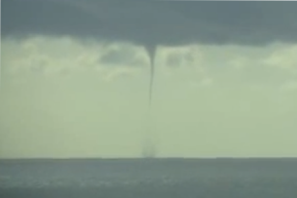
It comes after sightings of "tornadoes" and twisters in several parts of the country yesterday, including one off the coast of Plymouth (pictured above) and another in Alfreton, Derbyshire, where firefighters responded to call outs including to a house which lost a roof.
Derbyshire Fire and Rescue fire crews spent several hours ensuring the safety of buildings that had been damaged and took to using the hashtag Alfreton tornado on Twitter, while others were reportedly sighted near the Wirral and in south Cumbria.
A spokesman for MeteoGroup said while conditions were suited to tornadoes yesterday, they were less likely to appear today.
Forecaster Tom Tobler said: "Across southern Britain there will be gusts of around 50 to 55mph and this will spread eastwards throughout the day.
"There were some reports of tornados, including in the Wirral and Cumbria, and conditions were favourable to the formation of tornadoes.
"There will be some heavy showers and thunder storms around today, particularly in western areas but I would say not quite as much as yesterday - central and eastern areas won't see quite as many showers."
Arriva Trains Wales services between Fishguard Harbour and Camarthen were replaced by buses overnight after lightning strikes caused signalling problems, which were expected to last until later this morning (Thursday).
The Met Office's weather warning, covering an area from Cornwall to Bournemouth and Cardiff to Swansea, read: "Southwesterly winds will strengthen through Wednesday evening with gales expected overnight.
"Gusts are likely to reach 50mph quite widely, with 60mph gusts possible across exposed coasts and headlands, and also in association with squally, thundery showers. Winds will then moderate through Thursday morning.
"The public should be aware of the potential for some minor disruption."

Related articles
Twister spotted off the coast of Plymouth
Train stuck in flood water: 90 passengers evacuated


