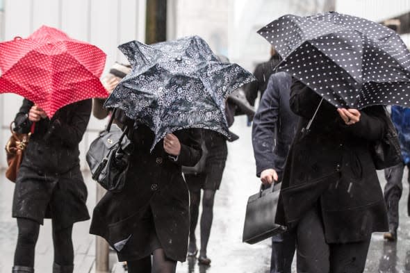
Brace yourself! Rain and flooding expected across UK on Saturday

Despite today's sunshine, some areas in Britain are expected to see nearly half of an entire month's rain fall in just an hour tomorrow.
Severe weather warnings have been issued covering much of the country amid fears of flooding.
The Environment Agency said there is a "low risk" of flooding for most of the country.
The Met Office said thundery rain is expected to start falling early tomorrow morning, with showers unlikely to ease off until the evening.
Some places could see between 0.8in (20mm) and 1.2in (30mm) of rain fall in an hour - almost half of the UK monthly average for the whole of June of 2.9in (73.4mm).
Met Office spokesman Dan Williams said the downpours will be "pretty heavy".
He said: "We are looking at the potential for some localised flooding because they are potentially heavy enough that we could see so much rain fall in a short space of time that it can't drain away fast enough."
Regions where yellow "be aware" warnings for rain are currently in place are North West England; North East England; Yorkshire & Humber; West Midlands; East Midlands; East of England; South West England; London & South East England; Strathclyde; Central, Tayside and Fife; South West Scotland; Lothian Borders; Northern Ireland; and Wales.
John Curtin, director of incident management at the Environment Agency, said: "There is a low but increased risk of flooding this weekend across the whole of England, as isolated torrential downpours are predicted.
"We are monitoring the situation closely in case things change and will have teams ready to respond 24/7. The Environment Agency is also supporting local authorities who will respond to any reports of surface water flooding."
The predicted deluge is down to warm, humid air moving in from Europe which creates a risk of downpours when it mixes with cooler air over the UK.
It has been a soggy 2014 so far, particularly in Reading.
Experts in the Berkshire town have recorded the wettest first five months of any year on record at their measuring site.
Dr Roger Brugge, a meteorologist at Reading University, said a total of 18in (462mm) fell between January and May - around 1in (25mm) more than in any other first five months of a year since records began in 1908.
His colleague, Dr Hannah Cloke, a flooding expert, said: "We could see flash floods in some parts of Britain if rainfall this weekend is as intense as has been predicted.
"The problem is likely to be exacerbated in areas where the ground is still wet from the winter floods, particularly in catchments with high groundwater levels and where rivers are still high following Britain's wettest winter ever."
It is not all bad news, however, with some areas expected to enjoy warm temperatures and some bright spells in between the showers.
The Met Office said the mercury could rise as high as 25C (77F) today and tomorrow in London and the South East - not far short of the warmest temperature of the year so far, 26.3C (79.3F).
Mr Williams said: "It is going to be one of those warm but humid days where you could see some bright spells but also some heavy showers as well."
He said the downpours will ease by Sunday when there will be some "good, dry and bright spells",
particularly in southern and eastern parts of the country and only a risk of light rain in some areas.
Next week is likely to be "slightly unsettled" with some dry and bright conditions along with light showers, he added.
Friends of the Earth climate campaigner Guy Shrubsole said: "After the wettest winter ever recorded it's clear that something is seriously weird with our weather.
"With the Met Office confirming this week that climate change is set to make heavy summer downpours the norm in future, the Government must take this threat far more seriously.
"It should start by putting carbon-cutting at the heart of policy-making, and building enough flood defences to keep pace with our changing climate - rather than having to splash out to repair the damage later on."
Related stories
'Tornadoes' appearing across Britain ahead of thunderstorms (pictures)
Thunderstorms and flash floods this weekend - but there's a heatwave coming!


