
Will the Polar Vortex bringing America to a standstill reach the UK?
The dangerously cold weather to hit America has brought record low temperatures and caused at least 21 deaths, and while Britain has experienced its own treacherous weather many people are wondering if the 'Polar Vortex' gripping the US could reach the UK?
The Met Office has extended its severe weather alerts until Thursday morning with more rain and flooding expected in the south of England and Wales.
According to Sky News, the US weather system is set to reach Britain on Friday.
Sky's U correspondent Dominic Waghorn says: "Meteorologists warn that when a polar vortex breaks up it scatters its forces literally to the four winds, meaning that the extreme weather experienced here this week could be flung as far afield as Europe."
But ITV Weather presenter Lucy Verasamy says the Polar Vortex will not reach Britain, writing that the freezing, arctic weather gripping the States would not survive the journey across the Atlantic.
Verasamy adds that by the time it reaches the UK, "it'll be no more than another batch of windy, wet weather."
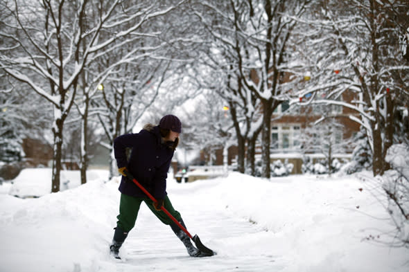
An increasing risk of snow has been predicted in the Met Office's long term forecast, with frost, ice and fog likely.
The Daily Telegraph reports that cold air pushed from America and Scandinavia will bring lower temperatures to the UK, but forecasters stress we won't experience the extreme conditions of the US.
Leon Brown of The Weather Channel tells AOL Travel: "We will see one more spell of wet weather tonight and then a change in the weather pattern as it becomes colder.
"Low pressure will move north east this evening and tonight across England and Wales with the wettest weather over Wales to the northern Midlands and northern England.
"Rain will turn to snow above 250m in Cumbria and northern England on Thursday morning with 5 to 10cm over the Pennines."
Leon adds: "After this, pressure will rise and the jet stream will become weaker and split allowing a colder block to develop over Scandinavia. The next Atlantic front to move east later on Friday will be a lot weaker with lighter rain followed by a dry weekend and overnight frost."
"There is a growing risk that the rain may turn to sleet and wet snow from the Midlands northwards on Monday, especially above 150m, but perhaps even at lower levels."
For next week, Leon warns of "the first real spell of winter with winds from the east. Expect night frosts and wintry showers in the east as high pressure builds over Scandinavia and the North Sea."

Related articles
Giant cod washes up on golf course in Wales
Boiling water turns into snow in frozen USA


